
Wednesday, July 24, 2013
We are on another adventure, this time to the Upper Peninsula of Michigan, fondly known as the UP. “Why are you going there?” we’ve been asked several times, and the answer is simply, “because we’ve never been there before!”
 We left this afternoon after some appointments, and set off
toward Buffalo. We decided to leave then, even though we didn’t have the entire
day to travel, because that would mean we’d arrive in Sault St. Marie, Michigan
by late afternoon Thursday, and we could then start our “real” trip.
We left this afternoon after some appointments, and set off
toward Buffalo. We decided to leave then, even though we didn’t have the entire
day to travel, because that would mean we’d arrive in Sault St. Marie, Michigan
by late afternoon Thursday, and we could then start our “real” trip.
Our journey took us through some parts of western New York
we’d never been in before, and they were quite beautiful. We turned off the
main highway in Mt. Morris, NY and took Rt. 20A across Wyoming and Erie
counties, seeing some pretty rolling hills and well-kept country towns.
When we arrived in Buffalo, we waited in a long line to
cross the Peace Bridge into Canada. The average time it took a car to go
through customs was about 1 minute. We upped the average when we went through,
as when the friendly young officer found out where we were headed, he took it
upon himself to give us some first-hand information on the areas we’d be
traveling through, where we might find a place to stay on the way, telling us
to watch out for wild animals once we got north of Barrie, and telling us he
thought the black flies wouldn’t be as bad now as they were a few weeks ago. He
wasn’t in any hurry, and gave us some valuable information. We do apologize to
the cars behind us, though!
We’d put some chicken and mushroom soup in the crockpot when
we left the house, so it was cooking all afternoon, and the smell was making us
very hungry. We had eaten a lunch of cheese and crackers, cherries and nuts
when we left Owego, but that was hours ago. We decided to drive to somewhere
north of Toronto before we stopped so we could avoid the traffic tomorrow. It
seemed like a good idea at the time, but the Toronto metropolitan and suburban
area is huge so it took us a couple of hours to get far enough north of the
city. There, of course, are no campsites near Toronto on the route we were on,
and we thought we might just pull up in a Walmart parking lot like we do in the
USA, but we saw only two Walmarts, and then only when we were passed them, and
had no idea in the maze of roads which ones to take to get back there. We
finally stopped 6 hours after leaving Owego at an Onroute, Canada’s name for a
superhighway service center. We were so happy that all we had to do was stop
the vehicle, get out the plates and dish up our dinner as it was 9:15 by that
time!
Using the crockpot to cook our supper while we are driving
is something we do on a regular basis when we are on a long drive. If we are
really camping and spending time somewhere, we will cook at the campsite, but
on the road, the crockpot is our savior.
We have traveled so much in our RV in the last 4 years, that
we have learned how to really “pack in” the supplies. I do not like spending
time grocery shopping when we travel, so we try to take a lot with us, and just
buy perishable items as we need them, or buy local specialty foods that we
would not be able to get in New York. So
our fridge is stocked with meat and lunch food for 8 days, and the drawers and
shelves hold the rest of the ingredients to make our meals. We’ll buy some fish
and local produce on our travels, too.
After exactly 4 years of ownership, our RV has almost 54,000
miles on it, and it has been to 41 of the 50 states and 8 of the 13 Canadian
Provinces. Needless to say, we love our RV and we love traveling in it!
Bob was remarking that of all of our trips, this one is the
least planned. Our first trip of 6 weeks was planned to the extreme because we
had so many places to go, and people to see at specific times. Since then, we
have been a lot less structured, and this time we just decided we wanted to
see the UP, but not how long we’d be gone, or where we are going other than
Sault St. Marie, Mackinac Island, Picture Rocks, and Copper Harbor, the most
northerly point in Michigan. Thankfully, our “jobs” allow us the leisure to do
this!
Thursday, July 25, 2013
We were awakened at 5:30 AM, way before we wanted to get up
by a beeping sound indicating that the refrigerator was not getting any power.
It was supposed to be running on propane overnight, but something was not
allowing it to run on propane and the battery was dead so it couldn’t run on 12
volts either. Actually, even on propane it needs electricity to start it, so
with no electricity stored in the battery, it stopped working. We had no electricity to plug into, so we had
to figure out what was wrong. Something drew the battery down overnight,
although very little was running, and finally Bob got power to the fridge again
about 6:30. We decided that since we probably wouldn’t be able to go back to
sleep, we’d eat breakfast and get on our way.
 The border guard had been correct in his travelogue. Once we
got past Barrie, the terrain changed significantly. There are few deciduous
trees, mostly just evergreens, and the farther northwest we went, the shorter
the trees became. The rocks were all granite with very little soil for growing
things. In one place crews were making the road into a 4-lane highway, and we
could see how they blasted away at the rock. They set blasting caps in red
cups, then covered the blasting area with thick rubber “blankets” made out of
recycled tires. This was to keep the rocks from flying all over when the blast hit.
After they blasted, they had crusher machines to make the rock particles small
enough to use in the road construction. About every 5 – 10 feet we’d see rocks
that had been piled into inukshuks, which were originally cultural symbols for
the Inuit, but now are often used as a symbol of Canada.
The border guard had been correct in his travelogue. Once we
got past Barrie, the terrain changed significantly. There are few deciduous
trees, mostly just evergreens, and the farther northwest we went, the shorter
the trees became. The rocks were all granite with very little soil for growing
things. In one place crews were making the road into a 4-lane highway, and we
could see how they blasted away at the rock. They set blasting caps in red
cups, then covered the blasting area with thick rubber “blankets” made out of
recycled tires. This was to keep the rocks from flying all over when the blast hit.
After they blasted, they had crusher machines to make the rock particles small
enough to use in the road construction. About every 5 – 10 feet we’d see rocks
that had been piled into inukshuks, which were originally cultural symbols for
the Inuit, but now are often used as a symbol of Canada.
We eventually got up just north of Lake Huron, and the
terrain changed again. This was actually along the St. Marys River. It was
flatter, and there was more soil, allowing for hay and other crops to be
planted and harvested.
 Finally, about 2:30 PM we crossed the border from Sault St.
Marie, Ontario, Canada into Sault St. Marie, Michigan, USA, and headed to a
nearby campground on the St. Marys River, the river connecting Lake Huron and
Lake Superior with the help of 4 large locks. Sault means rapids in Old French,
and this area of the river has rapids, which made it very difficult to use the
river to go from lake to lake. Also, Lake Superior is 21 feet higher than Lake
Huron, so the locks are needed for ships to be able to pass from lake to lake. We
went to the locks to watch the ships go through, but there was only one tour
boat, a tug, and a barge going through. When we got back to the campground we
watched for more ships to pass, but didn’t see any. We were treated to a wonderful
accordion concert by a fellow camper, however. It sounds corny, but he played
very well, and played lots of songs we know.
Finally, about 2:30 PM we crossed the border from Sault St.
Marie, Ontario, Canada into Sault St. Marie, Michigan, USA, and headed to a
nearby campground on the St. Marys River, the river connecting Lake Huron and
Lake Superior with the help of 4 large locks. Sault means rapids in Old French,
and this area of the river has rapids, which made it very difficult to use the
river to go from lake to lake. Also, Lake Superior is 21 feet higher than Lake
Huron, so the locks are needed for ships to be able to pass from lake to lake. We
went to the locks to watch the ships go through, but there was only one tour
boat, a tug, and a barge going through. When we got back to the campground we
watched for more ships to pass, but didn’t see any. We were treated to a wonderful
accordion concert by a fellow camper, however. It sounds corny, but he played
very well, and played lots of songs we know. Friday, July 26, 2013
After a leisurely breakfast, we went to the dock to catch a
tour boat through the Soo Locks. We passed a unique power plant built over 100
years ago and still used today. It is built of beautifully carved sandstone
with lighthouse “pillars” as a design, is a quarter mile long, and still gets
its power from water from the St. Marys River that passes through a specially
built canal into the building.
 |
| Note the name of the boat - "Nokomis," from "Hiawatha" |
The first two locks were built in the early 1900s and they
are rarely used today because the ships are too big for them. It is hoped that
one modern lock can be built where they are now, to replace the two. The fourth
lock was rebuilt in the 1960s, and is the lonely lock currently large enough
for the big cargo ships to go through.
The locks pass about 10,000 ships per year despite being
closed from January to March when ice shuts down the shipping in the Great
Lakes.
It took 10 minutes for MacArthur Lock to fill with 10
million gallons of water to enable us to go from the St. Marys River, which is
21 feet lower, into the bay leading into Lake Superior. We then went under the
International Bridge from Canada where cars and trucks were at a standstill
waiting to go through USA customs. Before the bridge was built in the 1960s, a
ferry went between the countries. Under
the bridge is a railway with at least three different kinds of trestles that
can be turned or raised in order to let ships through.
On the Canadian side of the river, we saw a huge steel mill,
which makes 700 different kinds of steel out of ore brought from towns in the
Upper Peninsula and Minnesota. We then went through a small Canadian Lock,
which is just used for pleasure craft and boats like our tour boat. The
Canadian side of the river does not have locks big enough for the large ships
to go through. They all must go through the American locks which are run by the
U.S. Corps of Engineers who charge no fee for their use.
 Just as we were finishing our ride, it started to rain, and
it poured off and on for several hours. We headed to Newberry to a logging
museum and then up to Tahquamenon State Park where we will stay for the next
two nights. The logging museum was very
interesting, and I was reminded that my great-grandfather was a logger in
Michigan in his early twenties. I hope to do more research when I have internet
connection and try to find out exactly where he was located. I know at one time he lived in Manistee,
Michigan, but I don’t know if he lived there the entire time he was in
Michigan.
Just as we were finishing our ride, it started to rain, and
it poured off and on for several hours. We headed to Newberry to a logging
museum and then up to Tahquamenon State Park where we will stay for the next
two nights. The logging museum was very
interesting, and I was reminded that my great-grandfather was a logger in
Michigan in his early twenties. I hope to do more research when I have internet
connection and try to find out exactly where he was located. I know at one time he lived in Manistee,
Michigan, but I don’t know if he lived there the entire time he was in
Michigan.
We took a short ride looking for moose, but saw none, then
walked down to the lower Tahquamenon Falls. Tomorrow we’ll hike to both the
Lower and Upper Falls.
Tahquamenon Falls was written about in Longfellow's poem "Hiawatha." Hiawatha is said to have built his canoe "by the rushing Tahquamenaw,"
Tahquamenon Falls was written about in Longfellow's poem "Hiawatha." Hiawatha is said to have built his canoe "by the rushing Tahquamenaw,"
Saturday, July 27, 2013
 We decided to hike from our campground to the Lower
Tahquamenon Falls and then on up to the Upper Falls – a distance of about 6
miles, all told. The Lower Falls are really 5 different falls, all gushing lots
of water. This could be because it rained a lot all day yesterday. The water
rushing over the falls is brown because of the tannin it picks up from tannic
acid found in the leaves and bark of trees that fall into the river.
We decided to hike from our campground to the Lower
Tahquamenon Falls and then on up to the Upper Falls – a distance of about 6
miles, all told. The Lower Falls are really 5 different falls, all gushing lots
of water. This could be because it rained a lot all day yesterday. The water
rushing over the falls is brown because of the tannin it picks up from tannic
acid found in the leaves and bark of trees that fall into the river.  The beginning of the hike was very slick, and quite steep in
places. In other places, there was just a path between weeds, and it is obvious
that not many people make this hike, as the path is so overgrown. We did pass
several hikers, but evidently not enough to keep the weeds down. The beginning
of the hike was right next to the river and we could see the rapids and the
foam caused by the mix of vegetation and speed of the water.
The beginning of the hike was very slick, and quite steep in
places. In other places, there was just a path between weeds, and it is obvious
that not many people make this hike, as the path is so overgrown. We did pass
several hikers, but evidently not enough to keep the weeds down. The beginning
of the hike was right next to the river and we could see the rapids and the
foam caused by the mix of vegetation and speed of the water.
We finally reached the top after about 3 hours, and then had
to go down 94 steps to get an “up close and personal” look at the Upper Falls.
They are only about 50 feet high, but are 200 feet across, and the water is
rushing rapidly over them at over 30,000 gallons a second, so they are quite impressive.
 The Upper Peninsula reminds us of the Adirondack area of NY
except there are no mountains here. It is mostly flat here in the eastern part
of the peninsula, with just a few hills. There are a lot of lakes, rivers, and
trees, however, just like the Adirondacks. Michigan also encourages ATV and
snowmobile riding, and they have hundreds of miles of trails all over the state
forests. Most of the Upper Peninsula was covered by huge trees when the loggers
came here during the early 1800s, but while it is still covered with trees,
most of them are not very wide, just tall.
The Upper Peninsula reminds us of the Adirondack area of NY
except there are no mountains here. It is mostly flat here in the eastern part
of the peninsula, with just a few hills. There are a lot of lakes, rivers, and
trees, however, just like the Adirondacks. Michigan also encourages ATV and
snowmobile riding, and they have hundreds of miles of trails all over the state
forests. Most of the Upper Peninsula was covered by huge trees when the loggers
came here during the early 1800s, but while it is still covered with trees,
most of them are not very wide, just tall.Sunday, July 28, 2013
 It rained a lot during the night, and was quite cold when we
woke up – about 50 degrees. We headed north on several unpaved, bumpy, back
roads, going into the Hiawatha National Forest, finally coming out along the
shore of Lake Superior. Pictured Rocks National Lakeshore was our goal, and we
arrived there and took the last campsite right on Lake Superior. The wind was
howling and the waves crashing, but it was a beautiful sight. We walked on the
beach for awhile, then decided we were so cold we needed to build a campfire
even though it was mid-afternoon. With the wind chill, the temperature had to
be in the 40s. We just put on every long-sleeved shirt we owned and huddled
around the campfire! We baked sweet potatoes in the coals, and steak over the
fire! A nice warm meal on a cold, cold day!
It rained a lot during the night, and was quite cold when we
woke up – about 50 degrees. We headed north on several unpaved, bumpy, back
roads, going into the Hiawatha National Forest, finally coming out along the
shore of Lake Superior. Pictured Rocks National Lakeshore was our goal, and we
arrived there and took the last campsite right on Lake Superior. The wind was
howling and the waves crashing, but it was a beautiful sight. We walked on the
beach for awhile, then decided we were so cold we needed to build a campfire
even though it was mid-afternoon. With the wind chill, the temperature had to
be in the 40s. We just put on every long-sleeved shirt we owned and huddled
around the campfire! We baked sweet potatoes in the coals, and steak over the
fire! A nice warm meal on a cold, cold day!Monday, July 29, 2013
 |
| Indian Head Rock |
 It is finally a beautiful, sunny, warm day. We hated to
leave our great campsite, but wanted to see the Pictured Rocks from the water,
so headed into Munising to catch a boat. They reported that the waves were 3-4
feet, and were worried about people getting seasick, so we took some Dramamine
and headed out. It was a beautiful day for a boat ride, and after a while, the
waves went from roller-coaster-like action to pretty much nothing. This was our
first time at a national lakeshore, and it is a beautiful place. It is called Pictured
Rocks because the colors of the minerals leaching through the sandstone cliffs make
patterns and pictures on the rocks, and because the erosion of some of the
rocks causes them to look like something – an Indian head, a flower vase,
battleships, etc. We really enjoyed the
trip. The sun was shining, and the boat ride was very relaxing
It is finally a beautiful, sunny, warm day. We hated to
leave our great campsite, but wanted to see the Pictured Rocks from the water,
so headed into Munising to catch a boat. They reported that the waves were 3-4
feet, and were worried about people getting seasick, so we took some Dramamine
and headed out. It was a beautiful day for a boat ride, and after a while, the
waves went from roller-coaster-like action to pretty much nothing. This was our
first time at a national lakeshore, and it is a beautiful place. It is called Pictured
Rocks because the colors of the minerals leaching through the sandstone cliffs make
patterns and pictures on the rocks, and because the erosion of some of the
rocks causes them to look like something – an Indian head, a flower vase,
battleships, etc. We really enjoyed the
trip. The sun was shining, and the boat ride was very relaxing |
| Lover's Leap |
 |
| Chapel Rock |
 |
| Bridal Veil Falls |
 The captain told us where to buy fresh fish, so we headed
there after the ride, only to find that they had no fresh fish today. We got
some smoked whitefish, smoked whitefish sausage, and fish dip – ground fish
with spices, sour cream, and cream cheese. Then we headed to Hiawatha National
Forest Campground on Lake Superior outside Munising where we camped for the
night. After a late dinner, we heard fireworks, and were treated to a great
fireworks display from several cottages along the lake. We were surprised that
they would shoot off so many expensive fireworks on an ordinary day, but I
decided it must have been in honor of my brother Dick’s birthday! (or someone
else’s special day)
The captain told us where to buy fresh fish, so we headed
there after the ride, only to find that they had no fresh fish today. We got
some smoked whitefish, smoked whitefish sausage, and fish dip – ground fish
with spices, sour cream, and cream cheese. Then we headed to Hiawatha National
Forest Campground on Lake Superior outside Munising where we camped for the
night. After a late dinner, we heard fireworks, and were treated to a great
fireworks display from several cottages along the lake. We were surprised that
they would shoot off so many expensive fireworks on an ordinary day, but I
decided it must have been in honor of my brother Dick’s birthday! (or someone
else’s special day)Tuesday, July 30, 2013
 |
| Copper Harbor is at the tip of the red area |
 We headed north to the most northerly place in Michigan,
Copper Harbor, on the tip of the Keweenaw Peninsula. It is a beautiful, serene
place! Keweenaw County is separated from the nearest county by the portage canal
built between the towns of Hancock and Houghton. The canal actually connects to Lake
Superior to itself with entries on the north and south across the peninsula. It was originally built
because there needed to be a faster way to transport the copper mined here, and
to get supplies to the towns of Houghton and Hancock which supplied most of the
smaller mining towns in the area.
We headed north to the most northerly place in Michigan,
Copper Harbor, on the tip of the Keweenaw Peninsula. It is a beautiful, serene
place! Keweenaw County is separated from the nearest county by the portage canal
built between the towns of Hancock and Houghton. The canal actually connects to Lake
Superior to itself with entries on the north and south across the peninsula. It was originally built
because there needed to be a faster way to transport the copper mined here, and
to get supplies to the towns of Houghton and Hancock which supplied most of the
smaller mining towns in the area. We are staying at a state park called Fort Wilkins. The old,
restored Fort Wilkins is within the park, and we went for a tour. It is the
only remaining wooden fort east of the Mississippi. The displays were well
done, and we got an idea of what the soldiers must have endured when they were
sent here. The fort was originally built so that there would be some soldiers
here to keep order when the huge copper boom started in the 1840s. The soldiers
first had to build the fort, and then man it. There were only 150 soldiers
stationed here, so it wasn’t very big, and the men didn’t have much to do, so
they were bored, and often got into trouble. At one time, a third of the men
were in the brig for drunkenness, gambling, or some other “horrendous” crime.
After two years, the fort closed and the soldiers were sent to fight in the
Mexican American War. The fort reopened after the Civil War for a short time.
We are staying at a state park called Fort Wilkins. The old,
restored Fort Wilkins is within the park, and we went for a tour. It is the
only remaining wooden fort east of the Mississippi. The displays were well
done, and we got an idea of what the soldiers must have endured when they were
sent here. The fort was originally built so that there would be some soldiers
here to keep order when the huge copper boom started in the 1840s. The soldiers
first had to build the fort, and then man it. There were only 150 soldiers
stationed here, so it wasn’t very big, and the men didn’t have much to do, so
they were bored, and often got into trouble. At one time, a third of the men
were in the brig for drunkenness, gambling, or some other “horrendous” crime.
After two years, the fort closed and the soldiers were sent to fight in the
Mexican American War. The fort reopened after the Civil War for a short time. Copper Harbor is of course named for the copper, which was
found here, and on the entire Keweenaw Peninsula, in 1843, six years before the
California Gold Rush. Copper had been discovered many hundreds of years earlier by the Native Americans, but the whites didn’t come up here until the 1800s. They first came to harvest the tall trees, but soon found the copper deposits, and the race was on! Copper was king on
the Peninsula for about 100 years because this is the only place in the world
where pure copper comes out of the ground. In other areas, the copper must be
mixed with other elements to make it into copper. (I’m not a scientist, but it
is something like that! LOL)
Copper Harbor is of course named for the copper, which was
found here, and on the entire Keweenaw Peninsula, in 1843, six years before the
California Gold Rush. Copper had been discovered many hundreds of years earlier by the Native Americans, but the whites didn’t come up here until the 1800s. They first came to harvest the tall trees, but soon found the copper deposits, and the race was on! Copper was king on
the Peninsula for about 100 years because this is the only place in the world
where pure copper comes out of the ground. In other areas, the copper must be
mixed with other elements to make it into copper. (I’m not a scientist, but it
is something like that! LOL) Copper Harbor is in a beautiful setting. Lake Superior is on
one side of the town, and Fanny Hooe Lake and the much smaller Lake Manganese, are on the
other side. 79 people live here year round, and the one-room school is still
used for the 9 students from preK to 8th grade. During the tourist season there are several
hundred other people who live here in their summer cottages, or are employed by
the hotels, restaurants, gift shops, etc. run for the tourist trade. Some of
the hotels are open in the winter, because the town is on one of the many
snowmobile routes that wend their way around the Upper Peninsula. We had
stopped at the local brewery for a beer, and were warmly welcomed. The waitress
said they stay open in the winter, but are only open from Thursday to Sunday
when the snowmobilers are around. The local general store had anything and
everything you could want from groceries, to fishing tackle, clothing, liquor
and wine. It reminded me of the old hardware store in Candor – “If we ain’t got
it, you don’t want it!” It's great that the market has so many things in stock, too, because the nearest large market is over an hour away!
Copper Harbor is in a beautiful setting. Lake Superior is on
one side of the town, and Fanny Hooe Lake and the much smaller Lake Manganese, are on the
other side. 79 people live here year round, and the one-room school is still
used for the 9 students from preK to 8th grade. During the tourist season there are several
hundred other people who live here in their summer cottages, or are employed by
the hotels, restaurants, gift shops, etc. run for the tourist trade. Some of
the hotels are open in the winter, because the town is on one of the many
snowmobile routes that wend their way around the Upper Peninsula. We had
stopped at the local brewery for a beer, and were warmly welcomed. The waitress
said they stay open in the winter, but are only open from Thursday to Sunday
when the snowmobilers are around. The local general store had anything and
everything you could want from groceries, to fishing tackle, clothing, liquor
and wine. It reminded me of the old hardware store in Candor – “If we ain’t got
it, you don’t want it!” It's great that the market has so many things in stock, too, because the nearest large market is over an hour away!
 Speaking of winter, this area’s average snowfall is 240
inches a year, about double what Syracuse gets in a year. The town of Delaware
had a sign saying they were the snowiest town in Michigan with an average of
301 inches! The record snowfall of 390 inches fell during the winter of
1978-79! Winter’s must be difficult in this area now, but imagine what it must
have been like before good roads and snowplows!
Speaking of winter, this area’s average snowfall is 240
inches a year, about double what Syracuse gets in a year. The town of Delaware
had a sign saying they were the snowiest town in Michigan with an average of
301 inches! The record snowfall of 390 inches fell during the winter of
1978-79! Winter’s must be difficult in this area now, but imagine what it must
have been like before good roads and snowplows! Above the town is Brockway “mountain” where there is a
wonderful overlook showcasing the whole town. Farther up the mountain is a 360
degree overlook where Lake Superior and several smaller lakes, the forest, etc.
can be seen. It is a beautiful, peaceful spot.
Above the town is Brockway “mountain” where there is a
wonderful overlook showcasing the whole town. Farther up the mountain is a 360
degree overlook where Lake Superior and several smaller lakes, the forest, etc.
can be seen. It is a beautiful, peaceful spot.
We cooked our dinner of chicken spiedies and fresh corn on
the cob over the fire, and also had fresh tomatoes. Yum!
 |
| Copper Harbor Lighthouse |
Wednesday, July 31, 2013
 |
| Eagle Harbor Lighthouse |
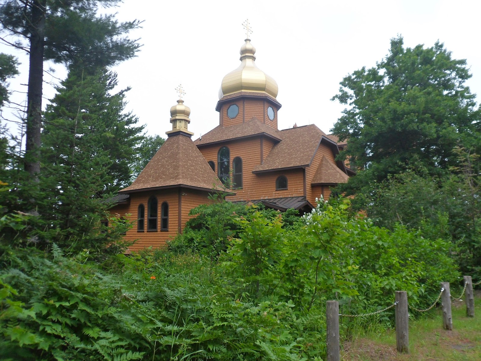 Along the way we spotted what looked like the golden dome of
a Greek Orthodox church, but as we got closer, it just looked like someone’s
very expensive cottage, right on the shore of Lake Superior. A little past there, we spotted a small
building advertising Abbey jams, jellies and bakery. I remembered that another
camper we met several days ago told us about the Abbey bakery, and suggested we
stop there. I didn’t remember where she had told us it was, so I was happy to
spot it. The monks had all kinds of baked goods there, and they charge quite a
bit, so I guess that’s how they were able to build such an impressive church!
We came away with two kinds of jam, fruitcake, abbey cake, and home-made candy!
Along the way we spotted what looked like the golden dome of
a Greek Orthodox church, but as we got closer, it just looked like someone’s
very expensive cottage, right on the shore of Lake Superior. A little past there, we spotted a small
building advertising Abbey jams, jellies and bakery. I remembered that another
camper we met several days ago told us about the Abbey bakery, and suggested we
stop there. I didn’t remember where she had told us it was, so I was happy to
spot it. The monks had all kinds of baked goods there, and they charge quite a
bit, so I guess that’s how they were able to build such an impressive church!
We came away with two kinds of jam, fruitcake, abbey cake, and home-made candy!
The grounds around the church are a rainbow of colors
because there are thousands of perennial flowers growing there. We saw many of
the flowers loaded with butterflies and bees happily spreading the pollen.
There was also an impressive vegetable garden there.

We then made another trek up Brockway Mountain because the
sun is out today, and we wanted to see the lakes and surrounding area with
sunlight shining on them. Needless to say, they were gorgeous! We plan to go
back up for the sunset tonight.
Dinner tonight was sweet potato roasted in the coals of the
fire, fresh fish, and garden-fresh summer squash! Our campground neighbors, a
father and his three sons, shared s’mores with us, and told us of the great
tour they took at Quincy Mine. I think we’ll go there tomorrow.
 It doesn’t get completely dark here until about 10 o’clock,
and the sun starts to set around 9:25, so we headed up the mountain to see the
show, and what a show it was! We were treated to the sight of two large
freighters, one of which was right in front of the setting sun. It made for a
beautiful picture. The ships normally aren’t this close to shore because they
are supposed to stay in the shipping lanes – 5 miles off shore for westbound
ships, and 12 miles off shore for eastbound ships. This afternoon we had seen a
huge sailboat, like a clipper ship, and one of the many people watching the
sunset said they had seen that sailboat and two more, and then found out that
the tall ships were sailing either to or from Duluth.
It doesn’t get completely dark here until about 10 o’clock,
and the sun starts to set around 9:25, so we headed up the mountain to see the
show, and what a show it was! We were treated to the sight of two large
freighters, one of which was right in front of the setting sun. It made for a
beautiful picture. The ships normally aren’t this close to shore because they
are supposed to stay in the shipping lanes – 5 miles off shore for westbound
ships, and 12 miles off shore for eastbound ships. This afternoon we had seen a
huge sailboat, like a clipper ship, and one of the many people watching the
sunset said they had seen that sailboat and two more, and then found out that
the tall ships were sailing either to or from Duluth. Lake Superior is the largest great lake, and the second
largest lake in the world by volume. If it was drained it would take all the
water from the other four great lakes, plus 4 more Lake Eries to fill it back
up. Another analogy is that it would take a four foot deep swimming pool the
size of the continental United States to contain all of Lake Superior’s water.
The Chippewa Indians called Lake Superior Kitchi or Gitche Gumee, and it was
immortalized in Longfellow’s poem “Hiawatha.”
Lake Superior is the largest great lake, and the second
largest lake in the world by volume. If it was drained it would take all the
water from the other four great lakes, plus 4 more Lake Eries to fill it back
up. Another analogy is that it would take a four foot deep swimming pool the
size of the continental United States to contain all of Lake Superior’s water.
The Chippewa Indians called Lake Superior Kitchi or Gitche Gumee, and it was
immortalized in Longfellow’s poem “Hiawatha.”
By the shores of Gitche Gumee, by the shining Big-Sea-Water,
Stood the wigwam of Nokomis, daughter of the Moon, Nokomis.
Dark behind it rose the forest, rose the black and gloomy pine-trees,
Rose the firs with cones upon them; bright before it beat the water,
Beat the clear and sunny water, beat the shining Big-Sea-Water.
Thursday, August 1, 2013
 |
| Hoist Building |
 |
| Steam Hoist |
 |
| Car for carrying miners up and down the shaft |
 |
| Ore Car |

 We then donned hardhats and miner’s jackets to begin our
tour of the mine. There were 92 levels in the mine, but 85 are now filled with water.
We went to the 7th level. We were transported down the steep hill by
a cog-rail tram. Then we transferred to a special heavy-duty wagon with a steel
cover pulled by a tractor to get back into the mine. This tour was not quite as
strenuous as yesterday’s! The section of the mine that we entered had
originally been a hole to allow the water inside the cave to exit. In the
1970s, Mich. Tech. received a grant to do some studies in the mine, and
enlarged the hole so that they could get in and out easily. They also had a
classroom down there, and it still looks like it could be used today.
We then donned hardhats and miner’s jackets to begin our
tour of the mine. There were 92 levels in the mine, but 85 are now filled with water.
We went to the 7th level. We were transported down the steep hill by
a cog-rail tram. Then we transferred to a special heavy-duty wagon with a steel
cover pulled by a tractor to get back into the mine. This tour was not quite as
strenuous as yesterday’s! The section of the mine that we entered had
originally been a hole to allow the water inside the cave to exit. In the
1970s, Mich. Tech. received a grant to do some studies in the mine, and
enlarged the hole so that they could get in and out easily. They also had a
classroom down there, and it still looks like it could be used today.


 Once we got far enough into the mine, we got off the wagon
and walked with our guide back into the mine. We were shown how the early
miners, working in teams of three, used just a steel rod and hammers to make
holes in the rock wall. Once a week they put dynamite into the holes they had
worked on that week, and the rock was blasted apart. Then other workers would
load the rocks onto a small cart and push them out to be loaded on to the
hoist. As the years passed, new
technologies were used to get the rock out, and fewer workers were required.
Quincy Mine had about 2,000 workers, only about 1/3 of whom worked inside the
mine. The rest operated the stamper(crusher) and smelters, or did other
necessary work.
Once we got far enough into the mine, we got off the wagon
and walked with our guide back into the mine. We were shown how the early
miners, working in teams of three, used just a steel rod and hammers to make
holes in the rock wall. Once a week they put dynamite into the holes they had
worked on that week, and the rock was blasted apart. Then other workers would
load the rocks onto a small cart and push them out to be loaded on to the
hoist. As the years passed, new
technologies were used to get the rock out, and fewer workers were required.
Quincy Mine had about 2,000 workers, only about 1/3 of whom worked inside the
mine. The rest operated the stamper(crusher) and smelters, or did other
necessary work.
Many of the workers were from foreign countries, starting
with the miners who came from Cornwall. Others came from Ireland, Finland, etc.
Since many of the miners couldn’t speak English, they couldn’t use phones for
communicating between the ground level and inside the mine. They came up with
their own kind of code using bells and lights, which worked well for
communication.

In the museum there is a huge piece of copper, 19 feet long and 8 feet wide. It weighs 17 tons and is worth $107, 440. It was found in
30 feet of water in 1991 and recovered in 2001.
 |
| Portage Canal |
 Around 2:00 we said goodbye to Keweenaw as we crossed the
Portage Canal between Hancock and Houghton and headed south toward St.
Ignace. We stopped for the night at a
state forest park called Portage Bay on Lake Michigan. It is a beautiful park
tucked away miles from anything else, and we shared the campground with only a
few others, not even seeing anyone from our campsite.
Around 2:00 we said goodbye to Keweenaw as we crossed the
Portage Canal between Hancock and Houghton and headed south toward St.
Ignace. We stopped for the night at a
state forest park called Portage Bay on Lake Michigan. It is a beautiful park
tucked away miles from anything else, and we shared the campground with only a
few others, not even seeing anyone from our campsite.
Friday, August 2, 2013
We don’t have far to go to get to St. Ignace where we will
camp for the night and then head to Mackinaw Island tomorrow. No vehicles are
allowed on the Island, so we will take our bikes with us on the ferry.

 Just before we got to St. Ignace, we saw a sign for pastys
(pass-tees). After over a week here in the Upper Peninsula, we knew that pastys
were meat pies, and we decided we should try one since we like to try local
food wherever we are in the world. So we stopped at the roadside stand
advertising that it had been in the business of selling pastys since 1947.
Several other people were stopping there, so we figured it was a good place,
and headed in to the shop. This shop ONLY sells pastys (and water and soda),
and they make a living at it! We drove to a nearby roadside park to eat our
local fare. (Michigan gets high marks for having clean, scenic, roadside parks
about every 10 miles). Well, we can say we tried a pasty, but we can’t say it
tasted good. It is mostly thinly sliced potatoes, onion, a little rutabaga for
flavor, so they say, and very little meat, surrounded by a pastry and cooked. I
think the inside mixture was cooked to death before it was cooked in the
pastry, but I don’t know for sure! This Upper Peninsula staple was brought to
the area by Cornish miners who gave it the name pasty.
Just before we got to St. Ignace, we saw a sign for pastys
(pass-tees). After over a week here in the Upper Peninsula, we knew that pastys
were meat pies, and we decided we should try one since we like to try local
food wherever we are in the world. So we stopped at the roadside stand
advertising that it had been in the business of selling pastys since 1947.
Several other people were stopping there, so we figured it was a good place,
and headed in to the shop. This shop ONLY sells pastys (and water and soda),
and they make a living at it! We drove to a nearby roadside park to eat our
local fare. (Michigan gets high marks for having clean, scenic, roadside parks
about every 10 miles). Well, we can say we tried a pasty, but we can’t say it
tasted good. It is mostly thinly sliced potatoes, onion, a little rutabaga for
flavor, so they say, and very little meat, surrounded by a pastry and cooked. I
think the inside mixture was cooked to death before it was cooked in the
pastry, but I don’t know for sure! This Upper Peninsula staple was brought to
the area by Cornish miners who gave it the name pasty.After our meal we headed to Straits State Park, which is right next to the bridge between the Upper and Lower Peninsulas. It was the best state park we have been in so far in Michigan as the sites were big and many of them were separated by small stands of trees. Our site was near the beach and we walked down and watched ships cross under the bridge from Lake Michigan to Lake Huron.


 On our way back we took a side street in Mackinaw City and
happened upon a Rendezvous, an 18th century trade fair. I was
curious at first because I didn’t see a sign about a rendezvous, but only a
sign about a Farmer’s Market, and lots of old-style white tents. I thought it
was a huge Farmer’s Market and was prepared to take pictures to show Jodi, who
is involved in two Farmer’s Markets at home. Then I saw some native teepees
covered with large sheets of bark. As we walked around, I realized the farmer’s
market, consisting of just one vendor, was separate from the rendezvous.
On our way back we took a side street in Mackinaw City and
happened upon a Rendezvous, an 18th century trade fair. I was
curious at first because I didn’t see a sign about a rendezvous, but only a
sign about a Farmer’s Market, and lots of old-style white tents. I thought it
was a huge Farmer’s Market and was prepared to take pictures to show Jodi, who
is involved in two Farmer’s Markets at home. Then I saw some native teepees
covered with large sheets of bark. As we walked around, I realized the farmer’s
market, consisting of just one vendor, was separate from the rendezvous.
The rendezvous vendors here had all sorts of goods that fur
traders might have sold way back when. Several of the vendors actually made the
goods using old-fashioned techniques, but many used a combination of
old-fashioned and modern techniques. We saw lots of furs for sale, iron items forged
by blacksmiths, wooden bowls, plates, and toys, handmade knives, etc. Most of
the vendors were dressed as they would have been in the 18th
century. Some of the people there were not selling anything. They simply like
collecting items from that time period and showcasing them. One man told us he
did it to teach history lessons, and he seemed to really enjoy letting people
touch all of the items he had from the 18th century and telling them
how they were used. Later during the
weekend they were going to have demonstrations, Native American dancing, etc.
It was a very interesting find for us, found just like most things in our
travels, just by wandering around!


Saturday, August 3, 2013
We took a ferry over to Mackinac Island to spend the day
with thousands of other tourists. (An average of 6,000 tourists a day visit in
the summertime!) The weather report said it was supposed to be mostly sunny
with a high of 69, however, that was WAY off! It was extremely cloudy and cold
all day, and we just about froze. We had worn shorts, so our legs were cold,
and we also wore our fleeces, but even with them on, we were very cold for much
of the day.
 |
| A ferry arriving at the dock |
Mackinac Island is located in the Straits of Mackinac which
separate the Upper and Lower Peninsulas of Michigan as well as separate Lake
Huron from Lake Michigan.
As soon as we landed at the island, we could smell a strong
odor of horse manure. That is because
 there are no motorized vehicles allowed
on the island and consequently they have hundreds of horses there to pull
taxis, carriages, drays, and just for people to ride! They also allow bicycles,
so we literally saw thousands of bicycles parked here and there, or with lots
of people riding by on one. The mob-like scene of so many people and bikes
reminded us of when we had visited Saigon several years ago, and bikes were the
primary means of transportation there.
there are no motorized vehicles allowed
on the island and consequently they have hundreds of horses there to pull
taxis, carriages, drays, and just for people to ride! They also allow bicycles,
so we literally saw thousands of bicycles parked here and there, or with lots
of people riding by on one. The mob-like scene of so many people and bikes
reminded us of when we had visited Saigon several years ago, and bikes were the
primary means of transportation there.
 there are no motorized vehicles allowed
on the island and consequently they have hundreds of horses there to pull
taxis, carriages, drays, and just for people to ride! They also allow bicycles,
so we literally saw thousands of bicycles parked here and there, or with lots
of people riding by on one. The mob-like scene of so many people and bikes
reminded us of when we had visited Saigon several years ago, and bikes were the
primary means of transportation there.
there are no motorized vehicles allowed
on the island and consequently they have hundreds of horses there to pull
taxis, carriages, drays, and just for people to ride! They also allow bicycles,
so we literally saw thousands of bicycles parked here and there, or with lots
of people riding by on one. The mob-like scene of so many people and bikes
reminded us of when we had visited Saigon several years ago, and bikes were the
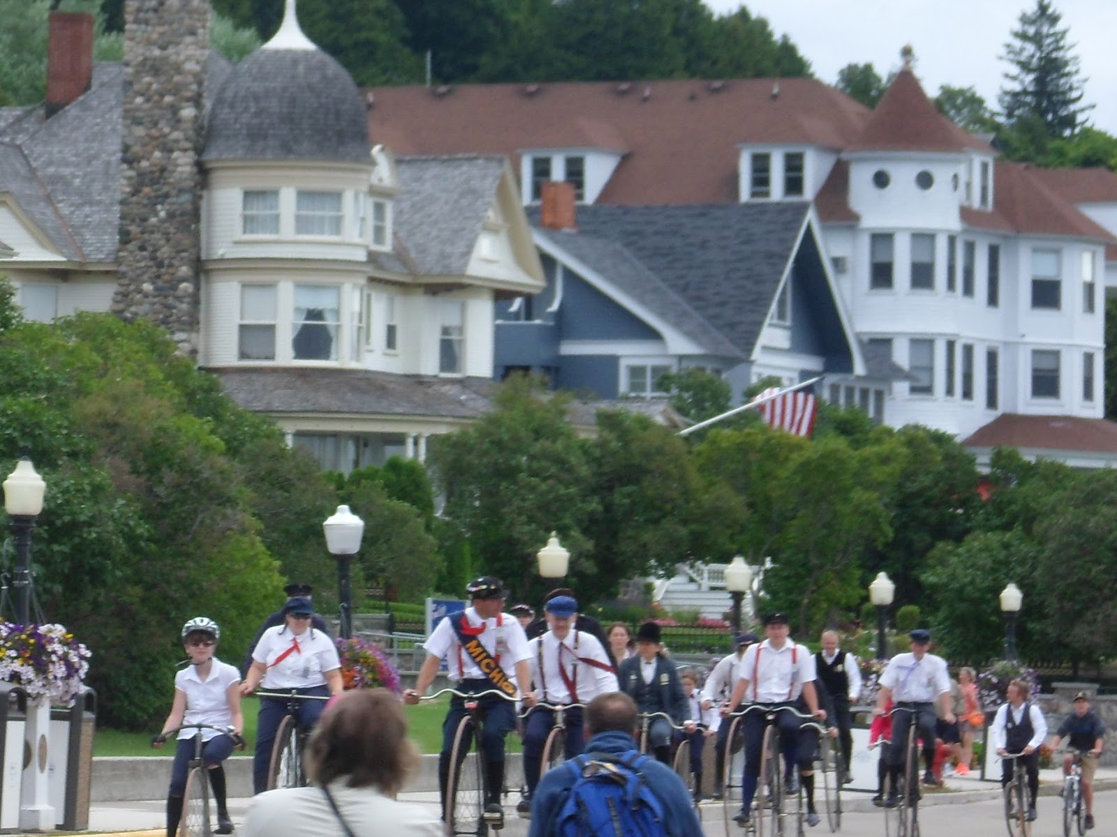
primary means of transportation there. The downtown “traffic” here on Mackinac was horrendous! You
literally took your life in your owns hands when trying to negotiate the main
street near the docks. Hundreds of people were walking along gazing at the shops. Hundreds more were haphazardly riding bikes, weaving in and out between other bikes and horse carriages, without much regard for safety. The drivers of the wagons, carriages, etc. were also attempting to weave around the pedestrians and bicycles! We had brought our bikes to ride, and pushed them for a
ways in order to get out of the mob before we tried riding with all of the
other hundreds of riders!
The downtown “traffic” here on Mackinac was horrendous! You
literally took your life in your owns hands when trying to negotiate the main
street near the docks. Hundreds of people were walking along gazing at the shops. Hundreds more were haphazardly riding bikes, weaving in and out between other bikes and horse carriages, without much regard for safety. The drivers of the wagons, carriages, etc. were also attempting to weave around the pedestrians and bicycles! We had brought our bikes to ride, and pushed them for a
ways in order to get out of the mob before we tried riding with all of the
other hundreds of riders!

 The first thing we did was to take a carriage ride around
the town so that we could get the “lay of the land.” The bright carriages with red seats and yellow trim are more like wagons with tops on them than
what you think of when you hear the word carriage. Anyway, we boarded the carriage,
which held about 20 people and was pulled by two big draft horses. Our guide, a
college student who had just learned to drive the team when she came to the
island two months ago, carefully wended her way through the mayhem of Main
Street and took us down some side streets pointing out significant places in
the history of Mackinac Island. Then we went up the big hill, and eventually
came to the stable area where we had to change to a bigger wagon pulled by a
team of three horses – nicknamed “the Cavalry” because the names of the horses
were Sergeant Slaughter, Corporal Travis, and Major Payne! With this larger
set-up we toured the State Park, which takes up about 80% of the island. Most
of the way was through narrow roads shaded by tall trees, and the wind was
blowing, so we go quite cold! We were happy to get off at the Fort for a tour
and some lunch, hoping to warm up in the restaurant.
The first thing we did was to take a carriage ride around
the town so that we could get the “lay of the land.” The bright carriages with red seats and yellow trim are more like wagons with tops on them than
what you think of when you hear the word carriage. Anyway, we boarded the carriage,
which held about 20 people and was pulled by two big draft horses. Our guide, a
college student who had just learned to drive the team when she came to the
island two months ago, carefully wended her way through the mayhem of Main
Street and took us down some side streets pointing out significant places in
the history of Mackinac Island. Then we went up the big hill, and eventually
came to the stable area where we had to change to a bigger wagon pulled by a
team of three horses – nicknamed “the Cavalry” because the names of the horses
were Sergeant Slaughter, Corporal Travis, and Major Payne! With this larger
set-up we toured the State Park, which takes up about 80% of the island. Most
of the way was through narrow roads shaded by tall trees, and the wind was
blowing, so we go quite cold! We were happy to get off at the Fort for a tour
and some lunch, hoping to warm up in the restaurant.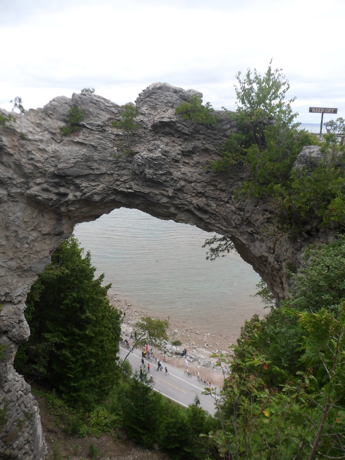 |
| Arch Rock |
The fort's restaurant is located in one of the old soldier’s
barracks, and the front patio overlooks the village, the harbor, and the
Mackinac Bridge, which was probably about 6 miles away. We first went inside to
eat, but it was colder there than outside, so we found a table outside and
warmed up with some hot tea and soup. We were shielded from the wind, so we did
warm up some, and after lunch we toured the fort, which dates back to pre-Revolutionary
War days.
The fort was originally built by the British in 1780, and
Americans took control in 1796. In July 1812, in the first land engagement of
the War of 1812, the British captured the fort. In a bloody battle in 1814, the
Americans tried to take back the fort, but failed. It was returned to the U.S.
after the war, and remained active until 1895.
 At first Mackinac Island was a center of fur trade, and the
soldiers were there to keep peace between the Indians and the fur traders. By
the 1880s, though, the island had become a major summer resort, and the
military presence was not really needed. Soldiers who lived there during that
time had a fairly easy time of it, and the officers seemed to do more
socializing than anything else.
At first Mackinac Island was a center of fur trade, and the
soldiers were there to keep peace between the Indians and the fur traders. By
the 1880s, though, the island had become a major summer resort, and the
military presence was not really needed. Soldiers who lived there during that
time had a fairly easy time of it, and the officers seemed to do more
socializing than anything else.
We were entertained by a squadron of “soldiers” who showed
us how to march and invited us to try marching with them. Then they fired their
rifles and their cannon as more entertainment.
Following that, we hiked back down the hill to get on our
bikes. One has to remember exactly where they parked their bikes, because as I
said, there are thousands of bikes parked along the streets like cars in
special lanes, or in bike racks, or just about anywhere. We had ridden only a
few blocks when my bike gave up the ghost – one of the sprockets just broke in
half for no apparent reason, other than the bike had been made in China! I
ended up renting a bike so we could have the experience of riding our bikes on
the 8 mile Michigan State Road 185 – the only highway in the nation where motor
vehicles are banned! This ban has been in effect since the 1890s!

 Despite that, we had a good time riding between the Lake
Huron shoreline and the woods. We passed several beautiful summer cottages
whose owners must also use bikes or call a horse-drawn taxi when they are on
the island. St. Ignace could be seen right across the water in one point, and
was probably only a couple of miles away, although the ferries need to take a
longer route of about 4 miles to get between the harbors of both towns.
Despite that, we had a good time riding between the Lake
Huron shoreline and the woods. We passed several beautiful summer cottages
whose owners must also use bikes or call a horse-drawn taxi when they are on
the island. St. Ignace could be seen right across the water in one point, and
was probably only a couple of miles away, although the ferries need to take a
longer route of about 4 miles to get between the harbors of both towns.
 |
| Grand Hotel |
The Governor’s “Summer Home” is also built on the bluff. The
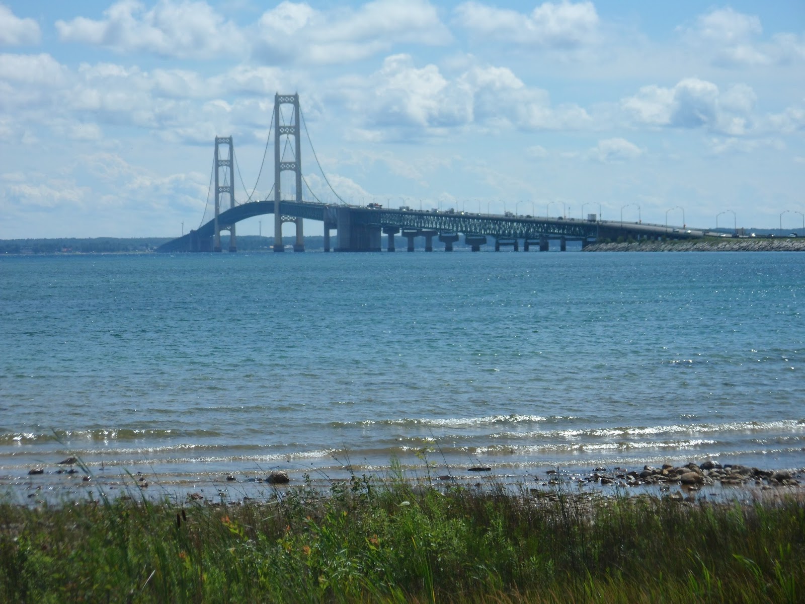
house was originally built for a private individual, but he went bankrupt and sold
it to the state for $15,000! The state won’t ever sell it, because they could
only ask $15,000 for it, and it is worth about $5,000,000 now!

In the early evening we left the island, climbed back in our RV, and started our trip back home, driving as far as Saginaw where we stopped for the night.
Sunday, August 4, 2013
We are on the final leg toward home – having about 455 miles
left to go. We will leave Michigan at Port Huron and cross the border into
Canada, going across to Niagara Falls where we will re-enter the US.


 |
| In case you don't know which way you are going. |
 |
| Duh...... |

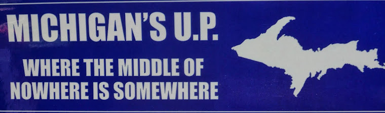
The Upper Peninsula is a unique place. It is part of the state of Michigan, but is cut off from the Lower, most heavily populated, part of Michigan by the Straits of Mackinac, so the only way to get to the other part of Michigan is to cross a bridge. The UP shares a land boundry with Wisconsin, but not Michigan! I'm sure that the downstate part of Michigan ignores the upper peninsula much like New York City ignores upstate, and visa versa. Also, the UP was settled by lots of hardy souls and many people were from Finland, Ireland, or Cornwall, so the people who live there have a regional dialect and words unique to them. This can make the citified parts of Michigan think that the people in the UP are backwards.
Here are some funny pictures or sayings about the UP.


